CALICHE.
Food forests on the land nobody wants.
For my family, and for Alice.

Twenty-one years from above
Watch the white patch lose. Tap any year for the full block — the neighbors are the control group.
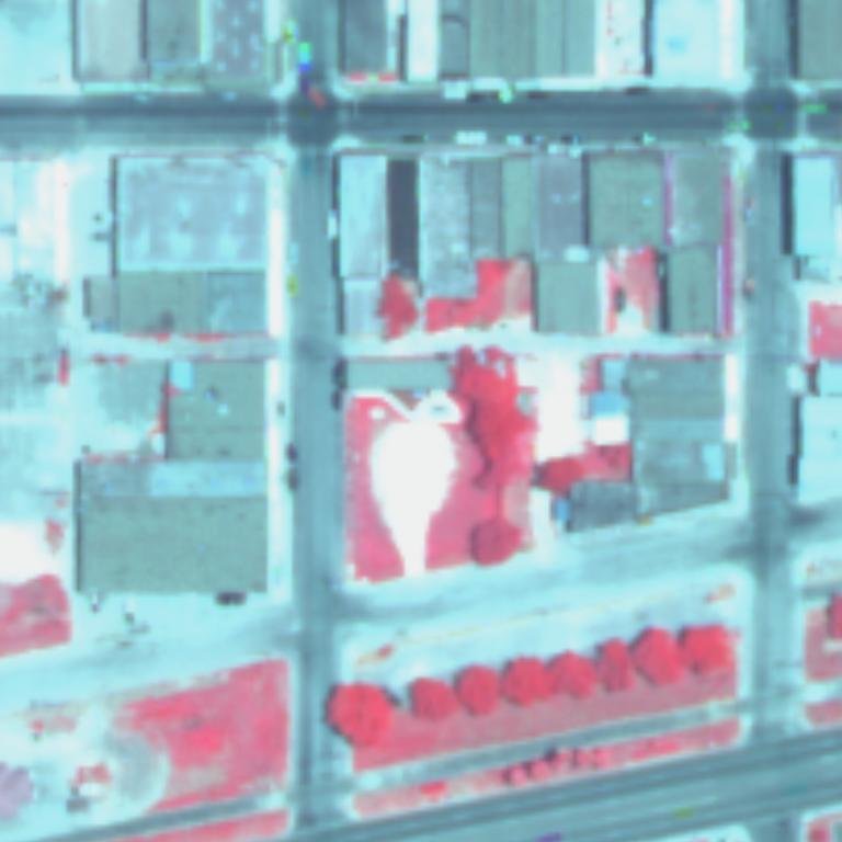
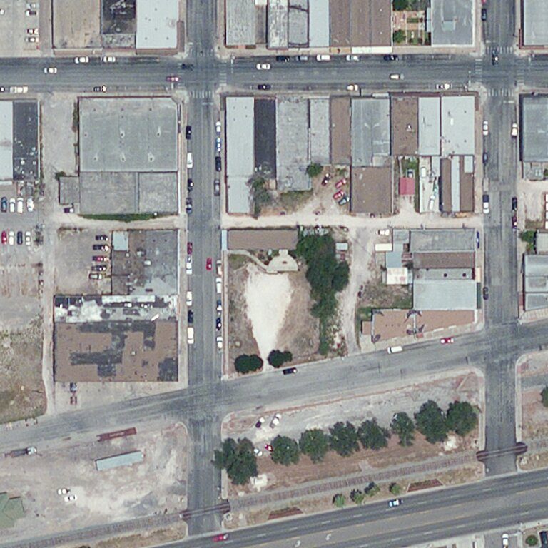
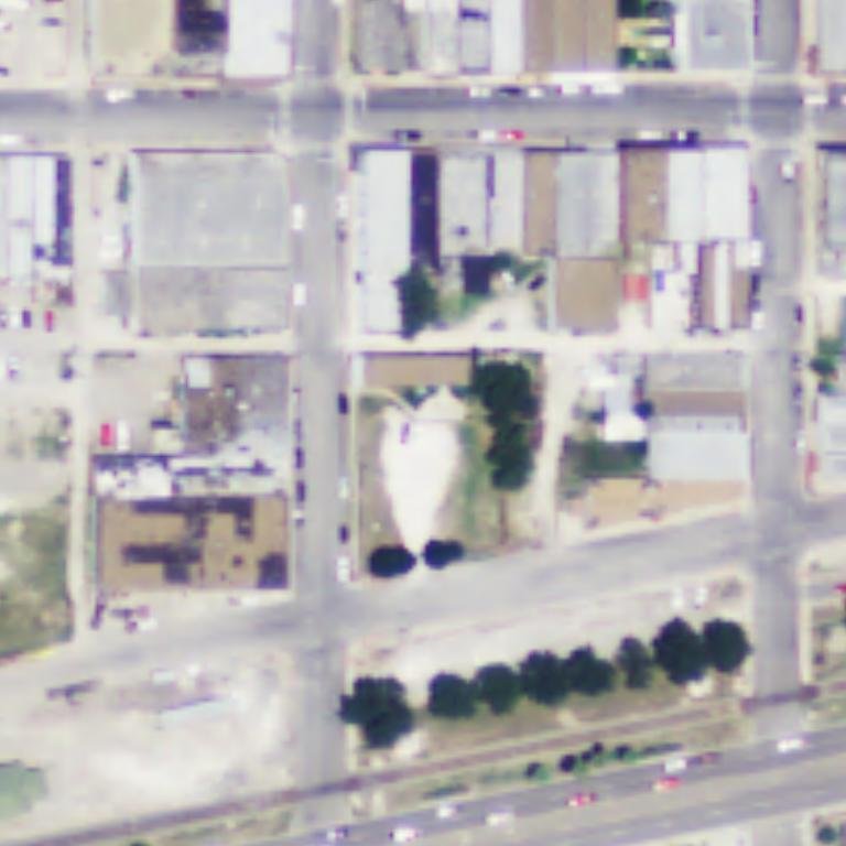
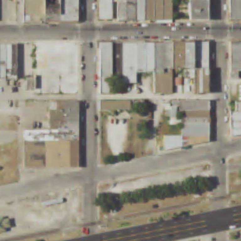
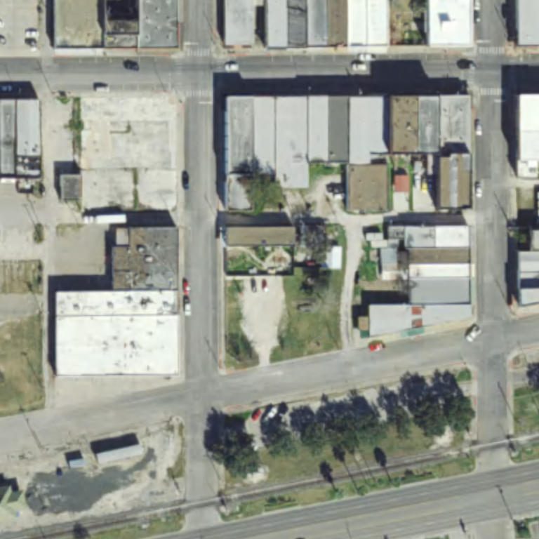
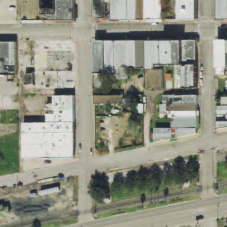
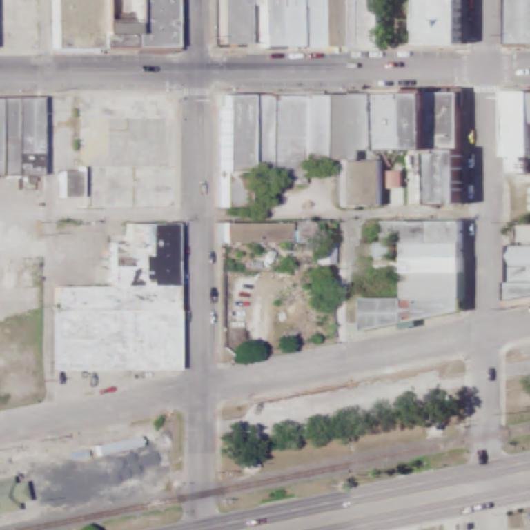
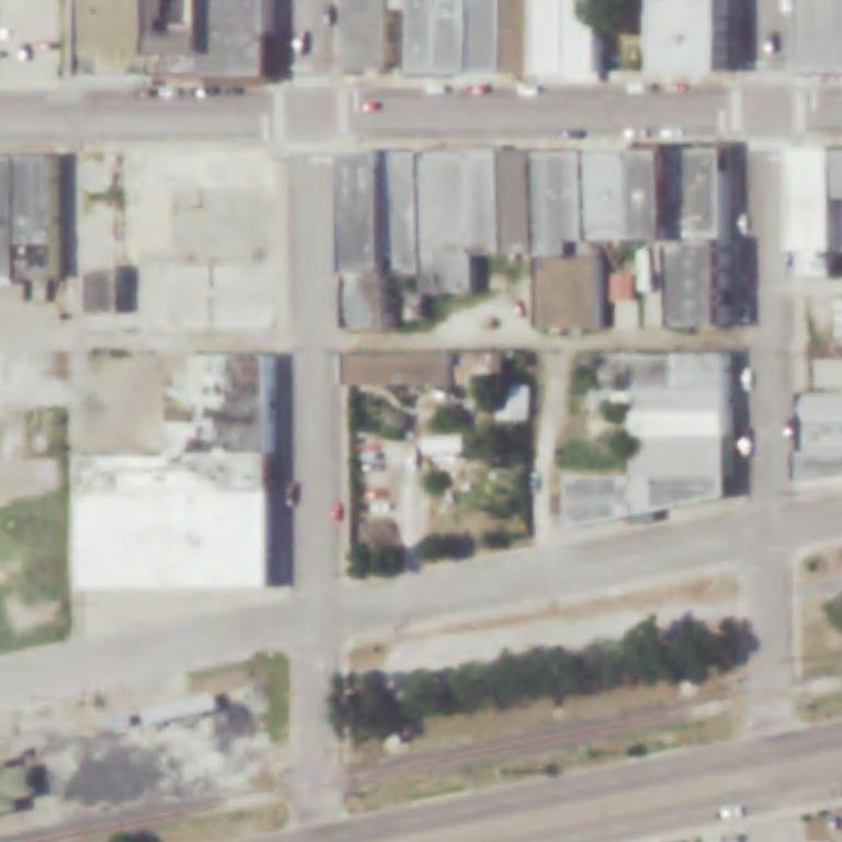
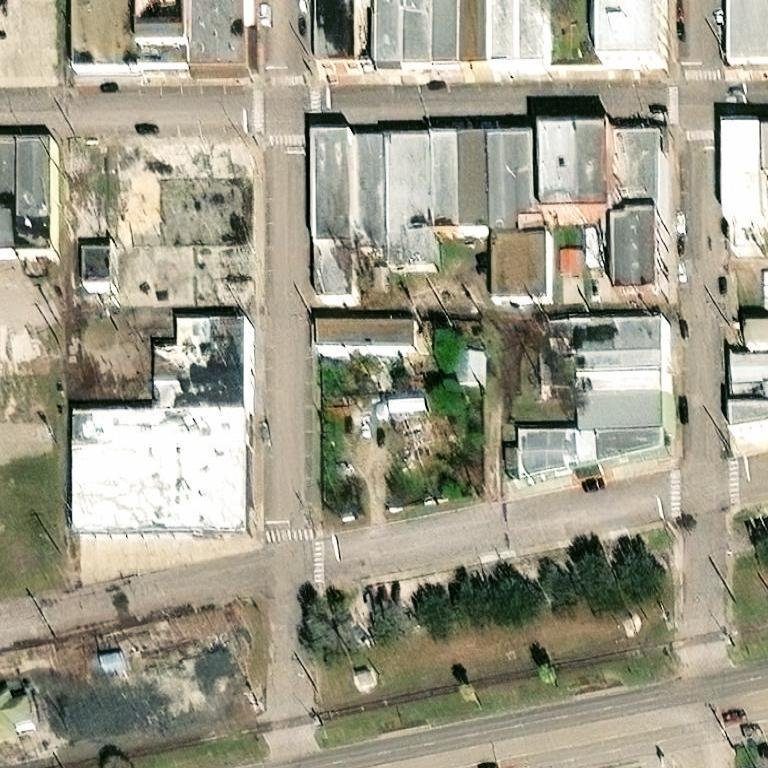
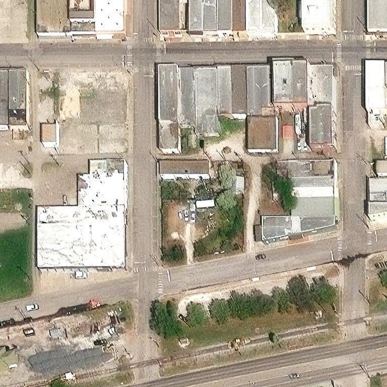
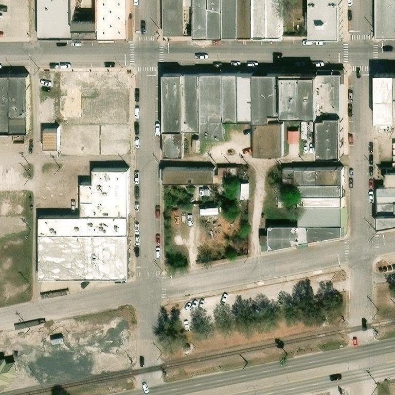
USDA NAIP aerials (Texas GIO, public domain) + Esri World Imagery Wayback — verify it yourself.
The method, in five lines
The loop
What we sell and what we plant are the same thing. That's the whole trick.
Goodwill in, bounty out, nothing wasted.
Why
You already know who taught me. Time to hand it forward.
Room at the table
A Texas nonprofit needs three directors to start. Ours has room for seven. No money, no quota, nobody's property — just judgment, and dirt under your nails when you feel like it.
The paperwork is drafted. The domain is ours. The proof is nine years old and fruiting. All it needs is us at a table, one afternoon, and twenty-five dollars.
Caliche doesn't take anybody's land. It plants on the lots nobody wants.
For folks who aren't from here
What is caliche?
The calcium-carbonate hardpan of South Texas — pale, concrete-like ground most plants can't root into. We named the project after the ground we beat.
What is a food forest?
Food-bearing trees, shrubs, vines, and groundcover arranged like a natural forest — designed to sustain itself with minimal care.
How does it survive drought without irrigation?
Biochar soil that holds water like a battery, deep watering that trains roots below drought, and a plant list picked by nine years of real survival.
Is it really visible from space?
Yes — every frame above is from public archives, and anyone can check the coordinates.